Ireland 5cm snow latest as forecasters say wintry showers in HOURS & Met Eireann issues snow-ice warning for 11 counties
SWATHES of Ireland are set to wake up to snow tomorrow — after the nation was battered by wind and rain today.
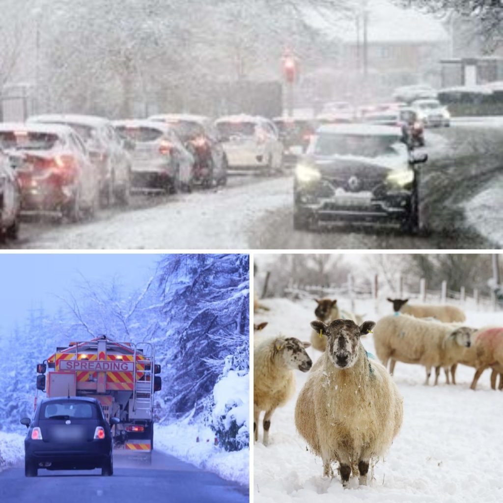
Met Eireann issued a yellow snow-ice warning for 11 counties, which will come into force at 9pm tonight.


And it remains in place for Cork, Donegal, Galway, Kerry, Leitrim, Limerick, Mayo, Sligo, Tipperary, Waterford and Wicklow until 9am tomorrow.
Forecaster Alan O’Reilly, of Carlow Weather, said many areas will have seen “wintry showers overnight” and early today.
He explained: “As that colder air moves in, showers will turn wintry.”
Met Eireann warned showers would fall as sleet or snow with some accumulations possible, mainly on high ground.
The white stuff alert followed a day of weather chaos, with ferry sailings cancelled and flights disrupted due to strong winds and heavy rain.
Irish Ferries revealed a raft of sailings were axed today, including the 7.30am sailing from Dublin to Holyhead, and the 1.15pm return journey.
Dublin Airport also told how savage winds caused disruption to flight operations today.
Spokesman Graeme McQueen said: “We’ve had three flights divert to other airports.
“We’ve had eight go-arounds as well, that’s where the incoming plane tries to come down and land on the runway, but the wind levels are too strong, and it goes back up again and then tries again.”
Cathal Nolan of Ireland’s Weather Channel reported wind speeds of up to 100kph today, with heavy rain already triggering localised flooding and hazardous travel conditions across the east.
The outlook remains grim tonight as temperatures are set to plummet to between 0C and 3C, bringing heavy showers and gale-force winds to Atlantic coasts.
Nolan added: “This particular band of heavy showers will come into parts of the country later on tonight, bringing with it a risk of rain, sleet and indeed snow as well.
“Snow is likely tonight to fall in many parts of the country – potentially accumulating in some areas and also over higher ground.
“We will see some appreciable falls of snow between 2cm and 5cm. There could be a little bit of disruption across higher elevation routes into the morning and even down to lower levels potentially for a time.
“At present, a cold front is lying across the country, bringing that heavy rain, tightly packed ice bars, and plenty of wind that is going to clear through over the next couple of hours.
“Heavy showers (will) start to push in between midnight and 6am. There will be some accumulations of snow especially in parts of Ulster into parts of Connacht.”
Isolated thunderstorms are also possible tomorrow with lows of -1C to +3C.
Showers will gradually become less frequent early on Friday night, becoming largely confined to Atlantic coastal counties with clear spells developing for a time.
Nicer weather is expected on Saturday, with highs of 7C to 10C across the country.
However, cloud will continue to thicken from the west through Saturday morning as patchy rain and drizzle spreads across the country during the afternoon.
Met Eireann added: “The rain and drizzle will become patchier towards morning with some clear breaks developing. Lowest temperatures of 3C to 7C.
“Sunday will be a cool and breezy day with sunny spells and scattered blustery showers, some turning wintry later in the day with a chance of hail or sleet, mainly in the north.
“Lowest temperatures of 3C to 7C with moderate to fresh and gusty westerly winds backing southwest by morning.”